


Across the Atlantic on a Container Ship
For years, we’d wanted to cross the Atlantic by ship instead of flying to Germany. Our options were a cruise ship or a cargo ship. Well, we’d already heard quite a bit from the press and from friends about traveling on cargo ships, so we decided to give it a try. Through a dynamic agency in Wuppertal that specializes in arranging international cargo ship voyages, we booked a trip on the “MS Balthasar Schulte,” from Callao/Lima to Hamburg.
On July 18, with our hearts pounding a little, we climbed the steep gangway and were warmly greeted at the top by Livio Udrea from Bulgaria, the third officer in charge of the guests. The “Balthasar Schulte,” with a gross tonnage of 40,542, is a large ship; for those unfamiliar with such measurements, it is 261 meters long, 32 meters wide, and can carry a maximum of 4,253 containers. It is operated by the German shipping company Thomas Schulte in Hamburg and flies the Liberian flag. Livio introduces us to the captain—called the “master” on the ship—a friendly older gentleman from Croatia. The rest of the crew consists of seven officers, three navigators, and four engineers, almost all of whom are from Russia. There are also 12 Filipino seafarers.
We move into our owner’s cabin—called a “cabin” on the ship—which consists of two separate rooms, each 14 m², with a private bathroom. Large windows provide plenty of light and, from a height of 30 m, a magnificent view of the sea, land (and containers). And then it’s already time for a meal. Breakfast and two hot meals are served on board, which we eat together with the officers in the mess hall. The dishes are tailored to the crew’s needs—extremely hearty, but generally too fatty for our taste. Joining us at the table is our only fellow passenger, Mr. Haag; we get along splendidly, and his presence on the voyage enriches our journey.
The next morning, we’re out on the high seas and step onto the bridge for the first time—the place from which the ship is steered. We’re always welcome here, and the officers on watch are always ready
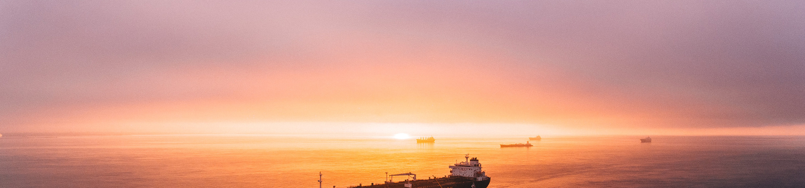
to answer our questions, as long as they aren’t busy with docking maneuvers or assisting the pilots on board. On the second day of the voyage, the captain organizes a small celebration in our honor. We sit outside on the railing as the sun sets in a blood-red glow, and the ship’s cook serves grilled shrimp and other delicacies. We have Budweiser beer to go with it; beer and wine are permitted on the ship, but alcohol is otherwise prohibited.
And then we’re already approaching the Panama Canal. We’re lucky and get to experience the passage during the day. In three lock chambers, we’re raised 27 meters from the Pacific Ocean to canal level. Our ship fits almost exactly into the 33.5-meter-wide chambers, held in place by four electric locomotives on either side using steel cables running through the center of the chambers. From the bridge, we keep our eyes and ears open, follow the pilots’ instructions, and during quiet moments have the procedures explained to us or simply chat with them. The canal turns out to be a narrow waterway only for the first 16 kilometers; the largest section in the east is the 64-kilometer-long Gatun Reservoir, before we’re lowered back down to Atlantic level through three locks. We’ve been awake for fourteen hours. The many images and impressions flooding in keep us from getting tired—a great experience even for us non-sailors.
The Caribbean Sea welcomes us with deep blue waters and warmth. So, what’s a good way to pass the time on board? Why not try traditional navigation at sea, from before the Global Positioning System (GPS) took over? To do this, we got a relevant reference book and two cardboard kits, which we used—with plenty of patience and glue—to build a sextant and a ring sundial. Using these two “instruments,” the current tables from the Nautical Almanac, and a quartz wristwatch, it’s possible—provided you don’t demand too much precision—to determine the ship’s geographical longitude and latitude at sea based on the sun’s position. We were at least able to determine the latitude to within 0.5°, which is about 55 km. It’s a good thing we have GPS today!
After just under two days sailing eastward, we reach Cartagena de las Indias in Colombia, where we go ashore for a few hours. The old town, with its surrounding wall, has retained its colonial style, making it a major tourist attraction in South America. We, too, enjoy the old architecture—if only the emerald vendors weren’t quite so pushy. Before reboarding, we stop for some fresh seafood. We don’t get fresh produce on the ship; everything comes from three large cold storage rooms. Perhaps we would have liked some fresh avocados, but those ripen in our containers in time for consumption in Europe.
From Cartagena, we set a northeasterly course across the Caribbean Sea for three days to the island of Hispaniola, on the eastern part of which the Dominican Republic is located today. We dock at the port of Caucedo and visit the capital, Santo Domingo, 40 km away. Although the historic old town has also been designated a UNESCO World Heritage Site, it cannot compare to Cartagena. The only part truly worth seeing is actually the eastern section of the old town along the Rio Ozama, with its well-preserved 16th-century buildings, including an imposing fort. On the square in front of the cathedral, featuring the monument to Diego Columbus—a son of Christopher Columbus—small bistros under tall plane trees invite visitors to enjoy a cup of coffee or a sundowner.
We sail around Hispaniola and head out into the Atlantic, a crossing that takes us eight days. But there’s never a dull moment. There’s always something to see on the bridge, or you can stop by for a chat with the officer on watch over a cup of coffee. There’s plenty of time to read—there are plenty of German books on board; my wife has stocked up on enough yarn and is knitting socks for the whole family. Our favorite spot for this is right at the very front of the ship’s bow. Here, it’s almost completely windless, and the lapping of the water drowns out the sound of the engines from the stern. We watch dolphins having fun racing the ship right in front of the bow. Flying fish can almost always be spotted, but whales rarely show themselves in the distance. In the evenings after dinner, when the weather is warm, we take a walk around the ship, hoping to photograph a classic sunset right over the sea—but unfortunately, we don’t succeed.
A group of people who are always smiling and friendly. On Friday evenings, the crew gets together for karaoke, and once we’re even invited to join in. Armed with a case of beer, we enter the common room, where we’re met by blaring music. One of the young men belts out “Strangers in the Night…” with full fervor, while others are moved to tears—that’s what karaoke means to Asians! Well, we can’t keep up with that. In a stroke of foresight, we’ve packed a CD of Bolivian music and, to the group’s loud applause, we take to the dance floor with a lively queca, thereby contributing to the success of the evening.
On the 17th day of our journey, the coast of Brittany comes into view on the starboard side in the afternoon, and we sail through the English Channel at night. There’s heavy ship traffic; on the port side, we encounter a brightly lit, majestic cruise ship, the “Queen Mary 2,” en route to New York. We spend part of the night on the bridge—there’s just too much to see and hear. Early in the morning, we enter the Maas River toward the port of Rotterdam, where we dock around 2:00 p.m. Rotterdam is the largest port in Europe, the third-largest in the world, and thus a competitor to Hamburg and Wilhelmshaven. We go ashore here as well. Rotterdam was bombed by the Germans in 1942 and almost completely destroyed. It is now a state-of-the-art city with several architecturally interesting buildings. We stroll through the city center, buy some authentic Dutch Gouda cheese, enjoy a delicious meal, and are back on board by 11 p.m.
On the North Sea, too, we encounter relatively heavy ship traffic: fishing boats with nets, coastal motor vessels, and, every now and then, drilling rigs extracting oil or gas. We enter the funnel-shaped mouth of the Elbe, a difficult channel for large container ships. Due to the tides and constantly shifting sediment loads, the shipping channel is always changing—a major challenge for the pilots. The height of the bridge grants us a sweeping view over the Elbe dikes to the Kehdin region, with its farmland and extensive orchards. We pass Blankenese, and soon the St. Michael’s Church in Hamburg greets us in the distance. On August 9, we dock at Burchardkai, where we disembark with a touch of sadness. But first, as a memento for his Bolivian guests and in gratitude for the excellent care provided by the entire crew, we present the captain with a table banner for the conference room featuring the colorfully embroidered coat of arms of Bolivia. If the steward doesn’t get too fed up with constantly having to dust off that silly thing, the llama, ear of wheat, and palm tree beneath the condor will continue to sail the seas aboard the “Balthasar Schulte” for a long time to come.
Finally, a few details about the trip. Anyone considering a voyage like this should plan well in advance—available spots are in high demand; we booked just under a year ahead of time. How much does a trip like this cost? We paid 2,565 euros per person for the three-week, all-inclusive voyage. That may seem expensive, but you have to keep in mind that there are very few additional expenses during the trip.
And was the trip worth it? The answer is: yes. We saw and learned a lot about Christian seafaring today, and on board, the entire crew always made us feel welcome.
C.N.-R